Great Smoky Mountains National Park: Visitor Guide
Great Smoky Mountains National Park is the most visited national park in the United States — receiving more than 12 million visitors annually, nearly double any other park. It straddles the Tennessee–North Carolina border, protects the largest old-growth forest in the eastern US, and contains more tree species than all of northern Europe. The “smoke” is a naturally occurring blue haze of organic compounds from the trees. And unlike every other major national park, it is entirely free.
Entry Fees and Passes
There is no entry fee to Great Smoky Mountains National Park. Entry is free year-round and no reservation is required to enter the park. This has been the case since the park’s founding, as a condition of the land donation that created it. The America the Beautiful annual pass is not needed but can still be purchased and is useful for other parks.
A parking permit (separate from entry) is required for all vehicle parking within the park. Approximately $5/day, $15/week, or $40/annual as of 2026. Purchased via recreation.gov before arriving or at automated kiosks at trailheads.
When to Visit
October foliage: The most popular period. Fall color in the Smokies is among the finest in the eastern US — the diversity of tree species (more than 100 native species) produces a wide color range from yellow birch and buckeye to red maple and scarlet oak, peaking mid-October at high elevations and late October in the valleys. Traffic on US-441 through the park can be extreme on October weekends — arrive before 8am.
April–May: Wildflower season. The park contains approximately 1,500 flowering plant species; the diversity peaks April through early June. Synchronized firefly viewing (see below) is late May through mid-June.
June–August: Hot and humid in the valleys (85–90°F); considerably cooler at Clingmans Dome (6,643 ft, often 50–60°F even in July). The most congested period. Arrive early or visit on weekdays.
November–March: Quieter. Snow at higher elevations from November through March makes Clingmans Dome Road and Newfound Gap Road occasionally closed (check road status at nps.gov/grsm). Black bears hibernate approximately December through March, reducing sightings.
Getting There
From Knoxville, TN (35 miles to the Sugarlands Visitor Center, approximately 45 minutes via US-441 S): The main northern approach. McGhee Tyson Airport (TYS) in Knoxville has broad flight connections. Car rental from approximately $45/day. The most convenient gateway.
From Asheville, NC (60 miles to the Cherokee/Oconaluftee Visitor Center on the south side, approximately 1.25 hours via US-74 W and US-19 N): Asheville Regional Airport (AVL) is a good alternative, particularly for the North Carolina side.
From Gatlinburg, TN (2 miles from the Sugarlands Visitor Center): The primary tourist town. Heavy traffic in fall and summer — plan for 20–30 minutes of Gatlinburg traffic even for the short drive to the park entrance.
From Cherokee, NC (1 mile from Oconaluftee Visitor Center on the south side): The quieter, less-visited approach. Fewer crowds than the Gatlinburg side.
No public transit serves the park. A car is required. The park’s main road (Newfound Gap Road, US-441) is 33 miles from Sugarlands (north) to Oconaluftee (south) and is one of the most driven national park roads in the US.
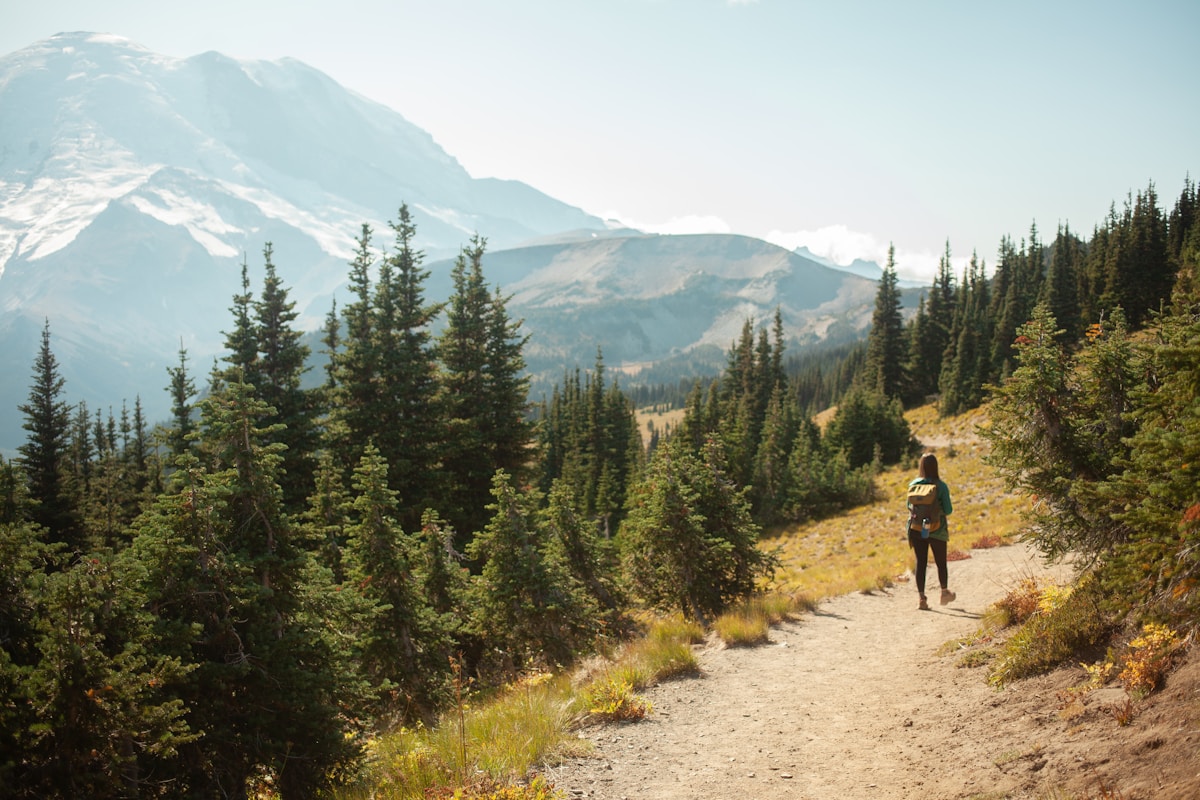
Must-See Trails and Attractions
Alum Cave Trail to Alum Cave Bluffs — 4.4 miles round trip (moderate, 2.5–3.5 hours) with 1,100 ft gain. Passes Arch Rock (a geological formation), Inspiration Point, and arrives at the concave Alum Cave Bluffs — a 100-foot overhanging cliff face. Beyond the bluffs (continuing to Mount LeConte): 10.8 miles round trip (strenuous, 5–7 hours). One of the best moderate hikes in the park.
Clingmans Dome — At 6,643 ft, the highest point in the park and on the Appalachian Trail. A 0.5-mile paved but steep walkway (moderate, 30–45 minutes) from the parking area leads to the observation tower with 360-degree views. On clear days, visibility extends 100 miles. Clingmans Dome Road closes December through March.
Laurel Falls — 2.6 miles round trip (easy, 1.5 hours). The most visited waterfall trail in the park — a paved path through old-growth forest to a 80-foot-wide two-tiered waterfall. Arrives at the falls quickly with no serious elevation gain.
Charlies Bunion — 8 miles round trip (strenuous, 4–6 hours) via the Appalachian Trail from Newfound Gap. Exposed rocky outcrop at 5,375 ft with sweeping ridge views. The clearest views in the park on low-humidity days.
Roaring Fork Motor Nature Trail and Grotto Falls — A one-way 5.5-mile auto loop road (open spring through fall) with old-growth forest and pioneer homesteads. Grotto Falls: 2.6 miles round trip (moderate, 1.5–2 hours), a 25-foot waterfall you walk behind.
Abrams Falls — 5 miles round trip (moderate, 2.5–3.5 hours) in the Cades Cove area. A 20-foot plunge waterfall into a deep pool. Despite the modest height, the volume of water makes it impressive. Trail involves creek crossings.
Cades Cove — An 11-mile one-way auto loop through a historic valley with preserved 19th-century homesteads, mills, and churches. The most consistent wildlife viewing area in the park — white-tailed deer and black bears are frequently seen at dusk. On summer weekends the loop can take 2–4 hours in traffic; Wednesday and Saturday mornings before 10am are car-free (bikes and pedestrians only).
Synchronized Firefly Event (late May through mid-June): Photinus carolinus fireflies synchronize their flashing in the Elkmont area for approximately 2 weeks. The NPS operates a mandatory shuttle system from Sugarlands Visitor Center during the viewing period (lottery for parking passes via recreation.gov — opens in April and is highly competitive). This is a genuinely extraordinary natural event.
Permits
Day hiking requires no permit beyond the parking fee.
Backcountry camping requires a backcountry permit, approximately $4/person/night as of 2026. Reservations available 30 days in advance via recreation.gov. Walk-up permits from the Backcountry Office. The park has 118 designated backcountry campsites and 18 shelters. Some shelter reservations are extremely competitive (LeConte, Double Springs Gap, Tricorner Knob on the AT).
Mount LeConte Lodge (accessed by trail only): Unique in-park hike-in accommodation — see Accommodation section. Reservation system constitutes a permit for the trail-side overnight stay.
Synchronized firefly shuttle lottery: Required during the firefly viewing period in late May/early June. Free lottery via recreation.gov opens approximately 30 days before the event. One of the most-sought park lotteries in the NPS system.
Accommodation
In-park (hike-in only):
- LeConte Lodge — Located at 6,593 ft atop Mount LeConte, accessible only by trail (shortest route: 5.5 miles one-way via Alum Cave Trail). Rustic cabins with meals included from approximately $155/person/night as of 2026. Open mid-March through mid-November. Reservations required at leconte-lodge.com — typically open one year in advance and sell out within hours for summer and fall.
Campgrounds (10 front-country campgrounds):
- Elkmont Campground — Largest in the park (220 sites), Tennessee side, near Sugarlands. Approximately $25–30/night. Reservations via recreation.gov — fills weeks ahead in October. The firefly viewing is centered here in May/June.
- Smokemont Campground — 142 sites, North Carolina side, open year-round. Approximately $25/night.
- Cades Cove Campground — 159 sites, far western end. Popular for wildlife viewing. Approximately $25/night.
Gatlinburg, TN (adjacent to the north entrance):
- Extremely wide range of accommodation from budget motels (approximately $70/night) to large resort hotels (approximately $150–300/night). Gatlinburg is heavily touristy with chain restaurants and attractions — useful for families but not for quiet nature trips.
Bryson City, NC (north Carolina side, 10 miles from the Oconaluftee entrance):
- A quieter gateway town on the Tuckasegee River. Inns and B&Bs from approximately $90–160/night. Smaller and more outdoorsy character than Gatlinburg.
Cherokee, NC — At the southern park entrance. Basic motels from approximately $80/night. Home of the Eastern Band of Cherokee Indians and the Museum of the Cherokee People (approximately $15 entry as of 2026).
Packing and Preparation
- Black bear safety: The park has approximately 1,500–2,000 black bears — one of the densest bear populations in the eastern US. Food storage is mandatory at all campgrounds and trailhead parking areas (use the provided food storage boxes). Carry bear spray on backcountry hikes. Bears in the Smokies are habituated to humans and require noise-making on trail.
- Ticks: The park has high tick density, including black-legged ticks carrying Lyme disease and lone star ticks. Check after every hike; wear permethrin-treated clothing and tuck pants into socks.
- Stream crossings: Many backcountry trails cross streams without bridges. Water levels rise rapidly during and after rain. Never attempt a crossing if water is above the knees and moving fast.
- Humidity: Unlike western parks, the Smokies are dense forest with high humidity June–August. Clothing that wicks moisture is far more important than UV protection; mold grows quickly in gear left wet.
- Road congestion: Newfound Gap Road during October foliage weekends can be at a complete standstill for hours. Visit mid-week or arrive before 7am.
- No cell service on most trails. Download offline maps on the NPS app or AllTrails Pro before entering the park.
- Lightning: The higher elevations (Clingmans Dome, Charlies Bunion, exposed AT ridges) are exposed to afternoon thunderstorms in summer. Descend from all summits by 1pm.
Book an experience
National Park in the area
Instant confirmation · Free cancellation on most bookings